
By María Gabriela Huertas Díaz, Assistant Planner + Marketing Coordinator at M-Group
I recently came across an article on City Lab titled “What France Can Teach U.S. Cities About Transit Design,” which talked about what the French call “the art of insertion,” and Americans refer to simply as “street design.” Although the article did not present any new information on street design American planners are unaware of, it made me remember another article I read about a year ago titled “African Bus Routes Redrawn Using Cell-Phone Data.” The second article talks about how researchers at IBM were improving the method for drawing bus routes “based on people’s movements as discerned from cell-phone data records.” Overlay the arguments of both articles and you can create a much more efficient approach to urban transit design.
Effective street design by itself is hardly enough to create a more efficient transit system, but the same applies vice versa. Hence, what would a more efficient model look like?
Consider this paragraph from the first article.
"You want to figure out where you want to locate lines to serve major destinations, then you want to use the road system to get from here to there," he says. "Streets are a resource. They're a right-of-way that goes from building façade to building façade. You should not think of them as entirely just infrastructure for moving automobiles. There's lots of different claimants on the use of that space, and a major transit line can be one of those claimants. And it can be made not to be some intrusive monster but to function along with the urban fabric."
There is no doubt the idea of creating a system that does not resemble an intrusive monster is beautiful. But, even though this article showcases French street design, it admits that creating a system that takes people where they want and need to go is priority number one. Again, nothing American planners do not already know, but here is where the second article comes in: Using cell-phone data to draw better bus routes.
I am no stranger to Americans’ wariness towards cell-phone data-tracking, especially by the government. The US has a strong legacy of privacy and private property, on which political campaigns, discourses, and debates often focus on. But would Americans accept the government using cell-phone data to design transit systems that benefit the very same people who are being tracked? The answer is unclear. Although IBM cleaned the data so the users could not be identified, information on these users’ movements was still made public.
Another question that rises is whether relying on cell-phone data would create a system around those who can afford the device. There is no question that better public transit benefits everyone, but it is low-income Americans who cannot afford a car, and perhaps a cell-phone, who rely on it the most. The Pew Research Center has been studying cell-phone ownership since 2004, and found that in 2013 91% of adults in the US owned a cell-phone, showing the data collected would provide an accurate and comprehensive picture of where Americans go. But still, the question of whether Americans would allow the government to track their movements to provide better transit options prevails. Not everyone believe better transit benefits everyone. Which brings me to article one once more.
Like the article mentions, the French government is generally more supportive of public transportation, and often redesigns streets to better accommodate pedestrians and transit at the expense of car lanes and street-parking. Such processes in the US repeatedly face strong opposition from community members, which shies politicians away from supporting such decisions. This relationship begs the question: is the lack of effective transit options in the US a product of community disinterest or weak leadership? The answer, again, is unclear.
What is clear is there are resources at our disposal to create better transit systems and effectively move Americans to and from their desired destinations. Whether we can or must use those resources is up for debate, but it is a debate worth having.
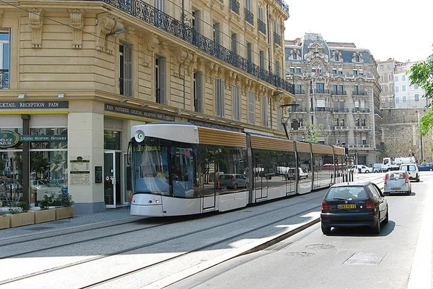
A tram in Marseille, France. (Mark Turner / Flickr)
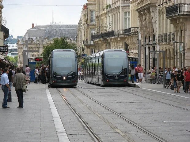
Trams arrive at stops in Bordeaux, France. (Andrew Batram / Flickr)
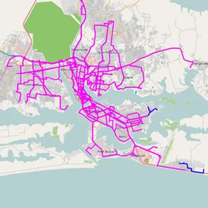
IBM map based on cell-phone data.